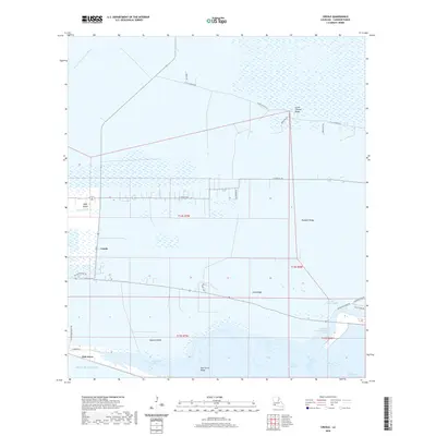
2020 Map of Creole
USGS Topo · Published 2020About this map
Creole and Oak Grove sit at the heart of this coastal Cameron Parish landscape, where the land and water of the Louisiana chenier plain transition into the Gulf of Mexico. The area is defined by its distinct series of ridges, including Little Chenier Ridge, Pumpkin Ridge, and Dans Ridge, which provide slightly elevated ground above the surrounding marshes and wetlands. These ridges have historically dictated the pattern of human settlement and transport in this part of the Chenier Plain.
Find a feature on this map
36 named features on this map. Tap any name to fly to it.
Don’t see what you’re looking for? This feature index may not catch every label — zoom into the map to look around manually.
Map Details
Editions of this 2020 Creole Map
This is the sole edition of this map. No revisions or reprints were ever made.
Other maps of this area

1934 · Lake Misere
USGS Topo · 1:24,000

1934 · Sweet Lake
USGS Topo · 1:24,000

1934 · Grand Bayou
USGS Topo · 1:24,000

1934 · Boudreaux Lake
USGS Topo · 1:24,000

1935 · Sweet Lake
USGS Topo · 1:31,680

1935 · Lake Misere
USGS Topo · 1:31,680

1935 · Boudreaux Lake
USGS Topo · 1:31,680

1935 · Grand Bayou
USGS Topo · 1:31,680

1935 · Bay Labauve
USGS Topo · 1:31,680

1935 · Grand Chenier
USGS Topo · 1:31,680