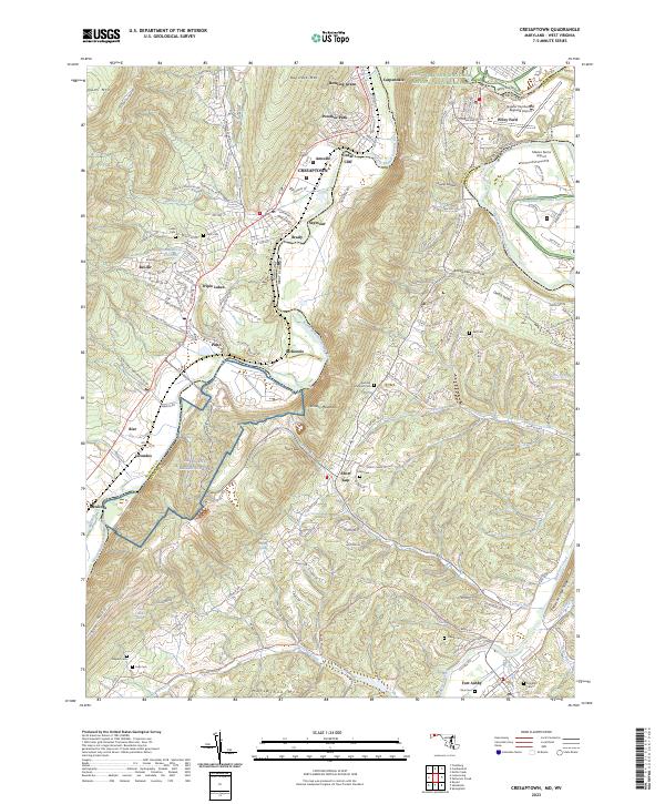
2023 Map of Cresaptown
USGS Topo · Published 2023About this map
The North Branch Potomac River serves as the winding boundary between Maryland and West Virginia, anchoring a landscape where aviation and industrial history meet. The Allegany Ballistics Lab occupies a significant portion of the riverbend near Pinto, reflecting the region's mid-century role in defense and aerospace engineering. This modern survey tracks the evolving suburban footprint of Cresaptown, Bel Air, and Bowling Green, while maintaining the corridor of the Chesapeake and Ohio Canal National Historical Park along the northern banks.
Find a feature on this map
154 named features on this map. Tap any name to fly to it.
Don’t see what you’re looking for? This feature index may not catch every label — zoom into the map to look around manually.
Map Details
Editions of this 2023 Cresaptown Map
This is the sole edition of this map. No revisions or reprints were ever made.
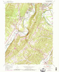
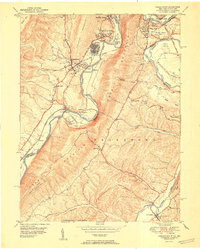
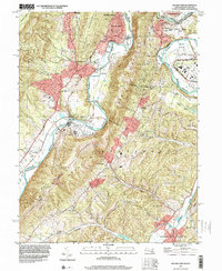
Historical Maps of Pinto Through Time
4 maps found