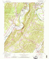
1949 Map of Cresaptown
USGS Topo · Published 1987About this map
The North Branch Potomac River serves as the focal point for this borderland study, where industrial development and family history intersect between Maryland and West Virginia. Early post-war industry is visible at Ameelle and the Cumberland Municipal Airport, while the legacy of 19th-century transport is preserved in the path of the Chesapeake and Ohio Canal. The map is particularly rich for genealogical research, documenting numerous family burial grounds including Brant Cem and Lease Cem tucked into the ridges of Haystack Mountain. Settlement patterns follow the river and rail corridors of the Baltimore and Ohio and Western Maryland lines, connecting local hubs like Cresaptown and the village of Fort Ashby. The landscape is defined by the steep relief of Dans Mtn and Knobly Mountain, creating a corridor that channeled both commerce and community life along the McMullen Highway.
Find a feature on this map
58 named features on this map. Tap any name to fly to it.
Don’t see what you’re looking for? This feature index may not catch every label — zoom into the map to look around manually.
Map Details
Editions of this 1949 Cresaptown Map
4 editions found
Other maps of this area

1891 · Romney
USGS Topo · 1:125,000

1898 · Frostburg
USGS Topo · 1:62,500

1899 · Flintstone
USGS Topo · 1:62,500

1900 · Flintstone
USGS Topo · 1:62,500

1901 · Frostburg
USGS Topo · 1:62,500

1908 · Frostburg
USGS Topo · 1:62,500

1920 · Keyser
USGS Topo · 1:62,500

1921 · Keyser
USGS Topo · 1:48,000

1921 · Hanging Rock
USGS Topo · 1:48,000

1922 · Keyser
USGS Topo · 1:62,500