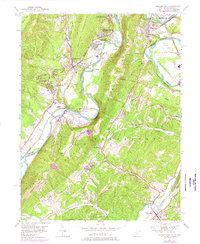
1949 Map of Cresaptown
USGS Topo · Published 1976About this map
The North Branch Potomac River serves as the winding centerpiece of this mid-century landscape, carving a deep valley through the ridges of Knobly Mountain and Dans Mtn. This area near the Maryland and West Virginia border reflects a complex transportation and industrial corridor. The Baltimore and Ohio and Western Maryland railroads trace the riverbanks, serving settlements like Cresaptown, Amcelle, and Bowling Green. Of particular interest to local historians is the Chesapeake and Ohio Canal alignment on the northern bend, adjacent to the Cumberland Municipal Airport and the Cumberland Fair Grounds. Further south, the rural character of West Virginia is defined by family-named landmarks such as Brant Cem and Old Furnace Ch near the banks of Patterson Creek. The presence of the Appalachian Orchard on the slopes of Horseshoe Mountain illustrates the agricultural heritage of the Potomac Highlands.
Find a feature on this map
49 named features on this map. Tap any name to fly to it.
Don’t see what you’re looking for? This feature index may not catch every label — zoom into the map to look around manually.
Map Details
Editions of this 1949 Cresaptown Map
4 editions found
Other maps of this area

1891 · Romney
USGS Topo · 1:125,000

1898 · Frostburg
USGS Topo · 1:62,500

1899 · Flintstone
USGS Topo · 1:62,500

1900 · Flintstone
USGS Topo · 1:62,500

1901 · Frostburg
USGS Topo · 1:62,500

1908 · Frostburg
USGS Topo · 1:62,500

1920 · Keyser
USGS Topo · 1:62,500

1921 · Keyser
USGS Topo · 1:48,000

1921 · Hanging Rock
USGS Topo · 1:48,000

1922 · Keyser
USGS Topo · 1:62,500