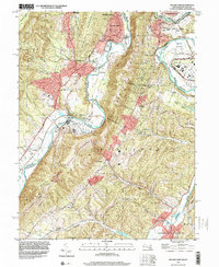
1997 Map of Cresaptown
USGS Topo · Published 2001About this map
The North Branch Potomac River defines the border between Maryland and West Virginia, cutting a path through the Appalachian ridges of Dans Mtn, Haystack Mountain, and Knobly Mountain. This landscape is characterized by the industry and infrastructure of the late 20th century, where the historic C & O Canal and the Old Railroad Grade run parallel to the water. The map captures a mix of small rail-side settlements and agricultural areas, including the Appalachian Orchard and industrial pockets like Amcelle.
Find a feature on this map
49 named features on this map. Tap any name to fly to it.
Don’t see what you’re looking for? This feature index may not catch every label — zoom into the map to look around manually.
Map Details
Editions of this 1997 Cresaptown Map
This is the sole edition of this map. No revisions or reprints were ever made.
Other maps of this area

1891 · Romney
USGS Topo · 1:125,000

1898 · Frostburg
USGS Topo · 1:62,500

1899 · Flintstone
USGS Topo · 1:62,500

1900 · Flintstone
USGS Topo · 1:62,500

1901 · Frostburg
USGS Topo · 1:62,500

1908 · Frostburg
USGS Topo · 1:62,500

1920 · Keyser
USGS Topo · 1:62,500

1921 · Keyser
USGS Topo · 1:48,000

1921 · Hanging Rock
USGS Topo · 1:48,000

1922 · Keyser
USGS Topo · 1:62,500