Loading...
Loading map...2022 Map of Crescent
USGS Topo · Published 2022About this map
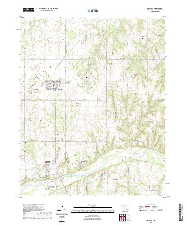
Crescent serves as the primary hub of this Logan County landscape, with its residential grid extending from E Sanderson St south to E Van Buren St. The area's settlement pattern is defined by the proximity to the Cimarron River, which flows through the southern half of the map, carving a wide valley flanked by terrace developments like Cimarron City and Cedar Valley. To the north, the land rises into a network of rolling drainage basins for Shawnee Cr and Wolf Cr.
Find a feature on this map
66 named features on this map. Tap any name to fly to it.
Don’t see what you’re looking for? This feature index may not catch every label — zoom into the map to look around manually.
Map Details
Date Portrayed2022
Date Published2022
PublisherU.S. Geological Survey
Map TypeTopographic
Scale1:24000
Physical Dimensions24 x 29 inches
Editions of this 2022 Crescent Map
This is the sole edition of this map. No revisions or reprints were ever made.
Historical Maps of Indian Springs Through Time
Featured Locations
Source Details
SourceU.S. Geological Survey
CopyrightPublic Domain