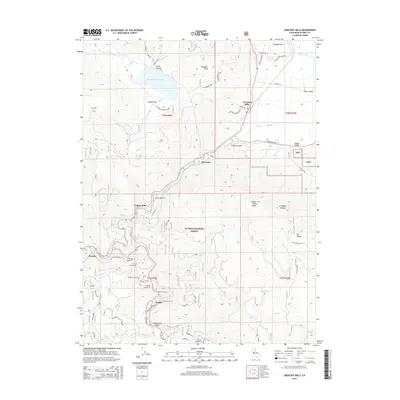
2015 Map of Crescent Mills
USGS Topo · Published 2015About this map
Indian Creek and its tributary canyons dominate this portion of the Sierra Nevada mountains within the Plumas National Forest. The map documents a complex mountain landscape where the railway engineers of the early 20th century carved a path through the steep terrain, evidenced by a sequence of eight consecutive tunnels including Tunnel Number 26 through Tunnel Number 33 near the settlement of Keddie. These tunnels track the narrow corridor alongside Spanish Creek and Butterfly Creek, illustrating the significant infrastructure required to traverse this region. Further north, the valley floor opens at Crescent Mills and Indian Valley, where the terrain flattens significantly compared to the high elevations of Hunodim Peak and Mt Hough. Water management is prominent at the Round Valley Reservoir, which sits perched above Bellas Flat, while small clusters like Indian Falls and Paxton mark the historical transit and settlement points along the river.
Find a feature on this map
56 named features on this map. Tap any name to fly to it.
Don’t see what you’re looking for? This feature index may not catch every label — zoom into the map to look around manually.
Map Details
Editions of this 2015 Crescent Mills Map
This is the sole edition of this map. No revisions or reprints were ever made.
Other maps of this area

1886 · Honey Lake
USGS Topo · 1:250,000

1886 · Lassen Peak
USGS Topo · 1:250,000

1888 · Bidwell Bar
USGS Topo · 1:125,000

1891 · Bidwell Bar
USGS Topo · 1:125,000

1891 · Downieville
USGS Topo · 1:125,000

1891 · Honey Lake
USGS Topo · 1:250,000

1892 · Lassen Peak
USGS Topo · 1:250,000

1893 · Bidwell Bar
USGS Topo · 1:125,000

1893 · Honey Lake
USGS Topo · 1:250,000

1893 · Downieville
USGS Topo · 1:125,000