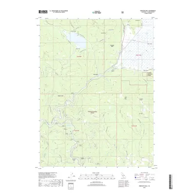
2018 Map of Crescent Mills
USGS Topo · Published 2018About this map
Crescent Mills and Indian Valley form the heart of this Plumas County landscape, where the confluence of Indian Creek and Spanish Creek meets the legacy of the region's mining and railroad history. The map documents a complex infrastructure of rail transport, marked by a dense sequence of tunnels including Tunnel Number 27 and Tunnel Number 33 near the settlement of Keddie. These engineering feats reflect the challenges of navigating the steep elevation changes between Hunodim Peak and the low-lying Butterfly Valley.
Find a feature on this map
65 named features on this map. Tap any name to fly to it.
Don’t see what you’re looking for? This feature index may not catch every label — zoom into the map to look around manually.
Map Details
Editions of this 2018 Crescent Mills Map
This is the sole edition of this map. No revisions or reprints were ever made.
Other maps of this area

1886 · Honey Lake
USGS Topo · 1:250,000

1886 · Lassen Peak
USGS Topo · 1:250,000

1888 · Bidwell Bar
USGS Topo · 1:125,000

1891 · Bidwell Bar
USGS Topo · 1:125,000

1891 · Downieville
USGS Topo · 1:125,000

1891 · Honey Lake
USGS Topo · 1:250,000

1892 · Lassen Peak
USGS Topo · 1:250,000

1893 · Bidwell Bar
USGS Topo · 1:125,000

1893 · Honey Lake
USGS Topo · 1:250,000

1893 · Downieville
USGS Topo · 1:125,000