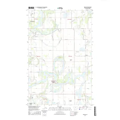
2017 Map of Creston
USGS Topo · Published 2017About this map
The Flathead River meanders through the expansive Flathead Valley on this 2017 survey, creating a complex network of wetlands and oxbow lakes including Church Slough, Egan Slough, and Half Moon Slough. The landscape is a mix of agricultural tracts and growing residential clusters such as Evergreen and Forest Hill Village. The rural character is preserved in the eastern reaches near the Flathead National Forest and the quiet waters of Lake Blaine. Small private airstrips like Weaver Airport and the Wounded Buck Ranch Airport are scattered across the valley floor, highlighting the region's reliance on general aviation. The map also documents specific local infrastructure like the Ashley Creek Bridge and significant thoroughfares such as Mennonite Church Rd and Columbia Falls Stage.
Find a feature on this map
97 named features on this map. Tap any name to fly to it.
Don’t see what you’re looking for? This feature index may not catch every label — zoom into the map to look around manually.
Map Details
Editions of this 2017 Creston Map
This is the sole edition of this map. No revisions or reprints were ever made.
Other maps of this area

1943 · Kalispell
USGS Topo · 1:125,000

1957 · Kalispell
USGS Topo · 1:250,000

1960 · Kalispell
USGS Topo · 1:250,000

1961 · Kalispell
USGS Topo · 1:250,000

1962 · Columbia Falls South
USGS Topo · 1:24,000

1962 · Doris Mountain
USGS Topo · 1:24,000

1962 · Rose Crossing
USGS Topo · 1:24,000

1962 · Lion Mountain
USGS Topo · 1:24,000

1962 · Somers
USGS Topo · 1:24,000

1962 · Creston
USGS Topo · 1:24,000