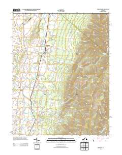
2013 Map of Crimora
USGS Topo · Published 2013About this map
The S River winds through the floor of the Shenandoah Valley, anchoring a landscape where agricultural lowlands transition sharply into the protected wilderness of Shenandoah National Park. Early twenty-first-century settlements like Crimora and Harriston are connected by a legacy of transport and industry, including the Norfolk and Western railway corridor and local landmarks like Red Mills. The eastern half of the map is dominated by the steep ascent to the Blue Ridge, featuring prominent peaks such as Turk Mountain and Rocks Mountain.
Find a feature on this map
134 named features on this map. Tap any name to fly to it.
Don’t see what you’re looking for? This feature index may not catch every label — zoom into the map to look around manually.
Map Details
Editions of this 2013 Crimora Map
This is the sole edition of this map. No revisions or reprints were ever made.
Other maps of this area

1892 · Harrisonburg
USGS Topo · 1:125,000

1931 · University
USGS Topo · 1:62,500

1934 · Waynesboro
USGS Topo · 1:48,000

1935 · University
USGS Topo · 1:62,500

1937 · Elkton
USGS Topo · 1:62,500

1939 · Waynesboro
USGS Topo · 1:62,500

1941 · Harrisonburg
USGS Topo · 1:62,500

1943 · Harrisonburg
USGS Topo · 1:62,500

1949 · Charlottesville
USGS Topo · 1:250,000

1956 · Charlottesville
USGS Topo · 1:250,000