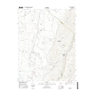
2016 Map of Crimora
USGS Topo · Published 2016About this map
The South River corridor defines the western half of this landscape, where the settlements of Crimora, Harriston, and Dooms sit along the valley floor. To the east, the terrain rises sharply into the protected wilderness of Shenandoah National Park, marked by the high elevations of Turk Mtn and Trayfoot Mtn. This proximity between the agricultural valley and the Blue Ridge crest is bridged by numerous drainage hollows such as Lefthand Hollow and Riprap Hollow. Genealogists and local historians can locate several burial sites, including Mountain View Cem near Sampson and the Old Cem further north. The map also traces the high-altitude path of the Appalachian National Scenic Trail as it winds along the ridge, offering a detailed view of the eastern boundary where Augusta County meets Albemarle County.
Find a feature on this map
116 named features on this map. Tap any name to fly to it.
Don’t see what you’re looking for? This feature index may not catch every label — zoom into the map to look around manually.
Map Details
Editions of this 2016 Crimora Map
This is the sole edition of this map. No revisions or reprints were ever made.
Other maps of this area

1892 · Harrisonburg
USGS Topo · 1:125,000

1931 · University
USGS Topo · 1:62,500

1934 · Waynesboro
USGS Topo · 1:48,000

1935 · University
USGS Topo · 1:62,500

1937 · Elkton
USGS Topo · 1:62,500

1939 · Waynesboro
USGS Topo · 1:62,500

1941 · Harrisonburg
USGS Topo · 1:62,500

1943 · Harrisonburg
USGS Topo · 1:62,500

1949 · Charlottesville
USGS Topo · 1:250,000

1956 · Charlottesville
USGS Topo · 1:250,000