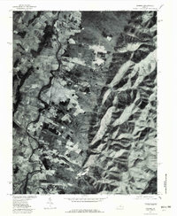
1977 Map of Crimora
USGS Topo · Published 1982About this map
The South River flows north through a valley defined by the steep slopes of the Blue Ridge in this 1977 orthophotograph. This aerial perspective, produced by the Geological Survey and the Soil Conservation Service, documents the rural agricultural and transport patterns around Crimora and Harriston. The landscape is sharply divided between the cultivated valley floor and the dense timber of the highlands, where Skyline Drive traces the ridge crest. Waterways such as Stull Run and Paine Run descend from the heights of Hall Mountain and Horsehead Mountain to feed the river system below. South of the main settlements, the community of Madrid sits near the headwaters of the S Fk Moormans River, illustrating the historic settlement patterns that followed the fertile lowlands adjacent to the mountain gaps.
Find a feature on this map
11 named features on this map. Tap any name to fly to it.
Don’t see what you’re looking for? This feature index may not catch every label — zoom into the map to look around manually.
Map Details
Editions of this 1977 Crimora Map
This is the sole edition of this map. No revisions or reprints were ever made.
Other maps of this area

1892 · Harrisonburg
USGS Topo · 1:125,000

1931 · University
USGS Topo · 1:62,500

1934 · Waynesboro
USGS Topo · 1:48,000

1935 · University
USGS Topo · 1:62,500

1937 · Elkton
USGS Topo · 1:62,500

1939 · Waynesboro
USGS Topo · 1:62,500

1941 · Harrisonburg
USGS Topo · 1:62,500

1943 · Harrisonburg
USGS Topo · 1:62,500

1949 · Charlottesville
USGS Topo · 1:250,000

1956 · Charlottesville
USGS Topo · 1:250,000