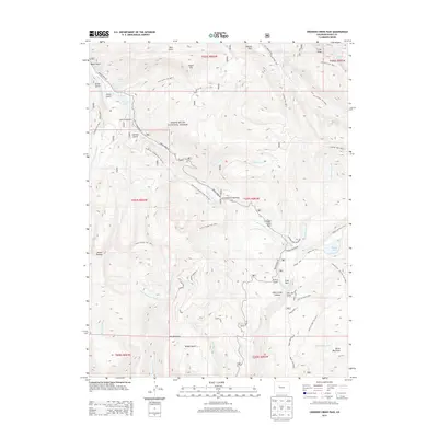
2013 Map of Crooked Creek Pass
USGS Topo · Published 2013About this map
White River National Forest defines this high-altitude landscape in Eagle County, dominated by a dense network of drainage systems and named peaks. The map center is anchored by the Crooked Creek Pass and Crooked Creek Park, where the headwaters of Crooked Creek and West Brush Creek converge. To the south, the terrain rises toward Mount Thomas and Burnt Mountain, while the northern reaches feature the broad meadows of Yeoman Park. Notable water bodies such as Sylvan Lake, Woods Lake, and the Crooked Creek Reservoir suggest a landscape managed for both irrigation and recreation. A sophisticated trail system, including the Mount Thomas Trail and Ironedge Trail, highlights the historical movement through these canyons and gulches, following the natural contours of Lime Creek Canyon and Slim Jim Gulch.
Find a feature on this map
68 named features on this map. Tap any name to fly to it.
Don’t see what you’re looking for? This feature index may not catch every label — zoom into the map to look around manually.
Map Details
Editions of this 2013 Crooked Creek Pass Map
This is the sole edition of this map. No revisions or reprints were ever made.
Other maps of this area

1909 · Mount Jackson
USGS Topo · 1:125,000

1911 · Mount Jackson
USGS Topo · 1:125,000

1957 · Leadville
USGS Topo · 1:250,000

1959 · Leadville
USGS Topo · 1:250,000

1960 · Leadville
USGS Topo · 1:250,000

1961 · Ruedi
USGS Topo · 1:24,000

1961 · Red Creek
USGS Topo · 1:24,000

1962 · Leadville
USGS Topo · 1:250,000

1962 · Grouse Mountain
USGS Topo · 1:24,000

1962 · Fulford
USGS Topo · 1:24,000