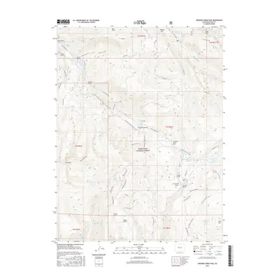
2016 Map of Crooked Creek Pass
USGS Topo · Published 2016About this map
White River National Forest encompasses this high-elevation landscape, where the waters of the East Brush Creek and Hat Creek basins converge. The map documents a complex network of forest access and recreation infrastructure, from the Powerline Crooked Creek Trail to the numerous spurs of the Jakeman system, including Jakeman Spur No. 2 and Jakeman Landing No. 1. Several significant alpine water bodies are recorded, most notably the Crooked Creek Reservoir and the naturally situated Sylvan Lake. High peaks like Mt. Thomas and Craig Peak overlook a terrain marked by deep gulches such as Alkali Gulch and Corral Gulch. Historical land use is evident in the transition from the secluded Yeoman Park to the dramatic Lime Creek Canyon, illustrating the varied topography of this section of the Rocky Mountains.
Find a feature on this map
73 named features on this map. Tap any name to fly to it.
Don’t see what you’re looking for? This feature index may not catch every label — zoom into the map to look around manually.
Map Details
Editions of this 2016 Crooked Creek Pass Map
This is the sole edition of this map. No revisions or reprints were ever made.
Other maps of this area

1909 · Mount Jackson
USGS Topo · 1:125,000

1911 · Mount Jackson
USGS Topo · 1:125,000

1957 · Leadville
USGS Topo · 1:250,000

1959 · Leadville
USGS Topo · 1:250,000

1960 · Leadville
USGS Topo · 1:250,000

1961 · Ruedi
USGS Topo · 1:24,000

1961 · Red Creek
USGS Topo · 1:24,000

1962 · Leadville
USGS Topo · 1:250,000

1962 · Grouse Mountain
USGS Topo · 1:24,000

1962 · Fulford
USGS Topo · 1:24,000