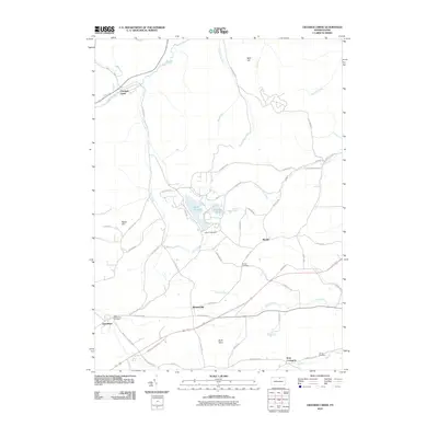
2010 Map of Crooked Creek
USGS Topo · Published 2010About this map
Hills Creek State Park serves as a central landmark for this part of Tioga County, encompassing Hills Creek Lake and the Hills Creek Dam. The surrounding landscape is defined by its small settlements and rural roads, with the community of Whitneyville positioned at the intersection of Charleston Rd and Ashley Rd. Waterways such as Lambs Creek and North Elk Run drain the rolling terrain between high points like Bald Hill and Reese Hill. For those researching local heritage, the map identifies several burial grounds including Bullock Cemetery and the Dartt Settlement Cemetery near Charleston. The settlement of Crooked Creek sits in the northwest, where the namesake Crooked Creek stream flows alongside local routes. This 2010 topographic record provides a clear view of the existing infrastructure and property boundaries in a region where small towns like Mardin and West Covington continue to anchor the local geography.
Find a feature on this map
57 named features on this map. Tap any name to fly to it.
Don’t see what you’re looking for? This feature index may not catch every label — zoom into the map to look around manually.
Map Details
Editions of this 2010 Crooked Creek Map
This is the sole edition of this map. No revisions or reprints were ever made.
Other maps of this area

1900 · Tioga
USGS Topo · 1:62,500

1900 · Elkland
USGS Topo · 1:62,500

1902 · Tioga
USGS Topo · 1:62,500

1925 · Blossburg
USGS Topo · 1:62,500

1927 · Blossburg
USGS Topo · 1:62,500

1944 · Blossburg
USGS Topo · 1:62,500

1946 · Antrim
USGS Topo · 1:62,500

1946 · Antrim
USGS Topo · 1:24,000

1948 · Antrim
USGS Topo · 1:24,000

1954 · Williamsport
USGS Topo · 1:250,000
Featured Places
- Tioga Township, PA
- Crooked Creek, Middlebury Township
- Whitneyville, Charleston Township
- Middlebury Township, PA
- Covington Township, PA