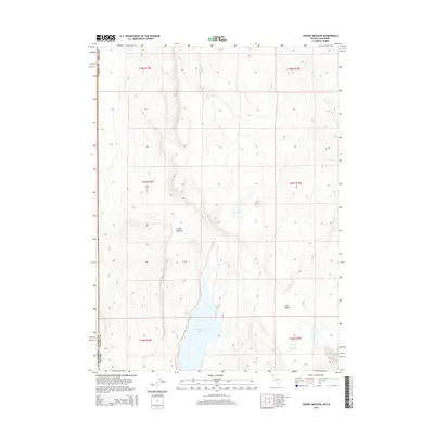
2015 Map of Crooks Meadow
USGS Topo · Published 2015About this map
Crooks Meadow sits in a high-elevation basin where the borders of Nevada and California meet, marking a transition between Washoe County and Modoc County. This landscape is defined by its seasonal hydrology and cattle-country character, centered around the expansive New Year Lake in the southern portion of the quadrangle. The map details a network of vital water sources for this high desert environment, including Big Spring, the descriptively named Pennywinkle Holes, and Frog Pond. To the southeast, the terrain descends into Holy Valley, while Bitney Brook provides drainage at the California line. The layout of section lines and township markers from the Public Land Survey System highlights the enduring importance of grazing allotments and land management in this remote corner of the Great Basin.
Find a feature on this map
17 named features on this map. Tap any name to fly to it.
Don’t see what you’re looking for? This feature index may not catch every label — zoom into the map to look around manually.
Map Details
Editions of this 2015 Crooks Meadow Map
This is the sole edition of this map. No revisions or reprints were ever made.
Other maps of this area

1886 · Alturas
USGS Topo · 1:250,000

1889 · Long Valley
USGS Topo · 1:250,000

1892 · Alturas
USGS Topo · 1:250,000

1954 · Vya
USGS Topo · 1:250,000

1954 · Alturas
USGS Topo · 1:250,000

1958 · Alturas
USGS Topo · 1:250,000

1958 · Vya
USGS Topo · 1:250,000

1962 · Alturas
USGS Topo · 1:250,000

1962 · Vya
USGS Topo · 1:250,000

1962 · Cedarville
USGS Topo · 1:62,500