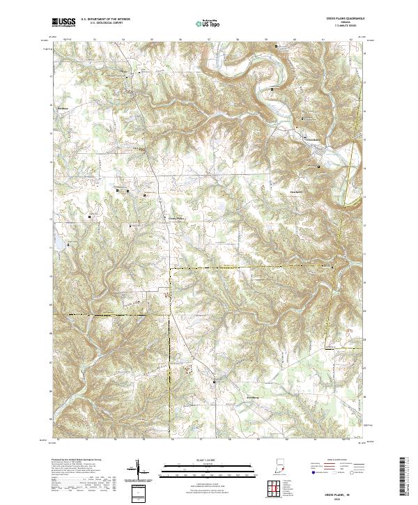
2022 Map of Cross Plains
USGS Topo · Published 2022About this map
Laughery Creek winds through the southeastern Indiana countryside, carving a deep valley that defines the landscape around Friendship. This area of Ripley County is characterized by high, narrow ridges such as Possum Trot Ridge and Salem Ridge, which separate the various creek branches. The settlement of Cross Plains sits at a crossroads on the central plateau, serving as a hub for the surrounding rural homesteads and agricultural tracts. A notable concentration of small family and community burial grounds, including the Nicholson Cem, Young Cem, and Beebe Cem, are scattered across the uplands, offering significant points of interest for genealogical research.
Find a feature on this map
62 named features on this map. Tap any name to fly to it.
Don’t see what you’re looking for? This feature index may not catch every label — zoom into the map to look around manually.
Map Details
Editions of this 2022 Cross Plains Map
This is the sole edition of this map. No revisions or reprints were ever made.
Other maps of this area

1943 · Vevay North
USGS Topo · 1:24,000

1946 · Versailles
USGS Topo · 1:24,000

1946 · Milan
USGS Topo · 1:24,000

1953 · Cincinnati
USGS Topo · 1:250,000

1956 · Bennington
USGS Topo · 1:24,000

1956 · Canaan
USGS Topo · 1:24,000

1956 · Louisville
USGS Topo · 1:250,000

1957 · Cincinnati
USGS Topo · 1:250,000
1957 · Vevay North
USGS Topo · 1:24,000

1958 · Dillsboro
USGS Topo · 1:24,000