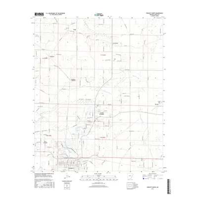
2017 Map of Crossett North
USGS Topo · Published 2017About this map
Crossett serves as the focal point of this Ashley County landscape, showing the city's northward expansion into North Crossett and West Crossett. The map documents a transition from the structured urban grid of the south to a more dispersed rural arrangement of smaller settlements and family landmarks. Significant genealogical data is preserved through a series of burial grounds including Pugh Cem, Crossroad Cem, Bethel Cem, and Simms Cem, which are scattered among the timberlands and creek bottoms.
Find a feature on this map
146 named features on this map. Tap any name to fly to it.
Don’t see what you’re looking for? This feature index may not catch every label — zoom into the map to look around manually.
Map Details
Editions of this 2017 Crossett North Map
This is the sole edition of this map. No revisions or reprints were ever made.
Other maps of this area

1934 · Ingalls
USGS Topo · 1:48,000

1934 · Felsenthal
USGS Topo · 1:62,500

1937 · Felsenthal
USGS Topo · 1:62,500

1937 · Ingalls
USGS Topo · 1:62,500

1938 · Felsenthal
USGS Topo · 1:62,500

1939 · Felsenthal
USGS Topo · 1:62,500

1939 · Ingalls
USGS Topo · 1:62,500

1952 · Fountain Hill
USGS Topo · 1:24,000

1953 · Greenwood
USGS Topo · 1:250,000

1953 · El Dorado
USGS Topo · 1:250,000