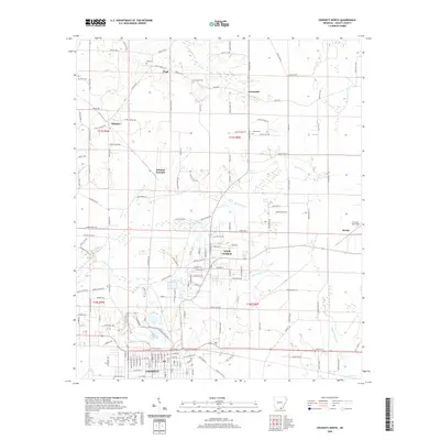
2020 Map of Crossett North
USGS Topo · Published 2020About this map
The town of Crossett and its northern neighbor North Crossett anchor this portion of Ashley County, showing the urban layout as it stood in the early 21st century. The landscape is defined by the drainages of Big Brushy Cr and Little Brushy Cr, which weave between small rural settlements like Pugh, Crossroad, and Whitlow. These locales are connected by an extensive network of county roads, including Ashley Rd 450 and Hancock Rd, revealing the persistent grid of southern Arkansas timber and farm country. Numerous family and community burial grounds, such as Pugh Cem and United Cem, are preserved here, providing essential locations for genealogical research. Further north, Whitlow Junction and the isolated site of Bovine mark the outer reaches of the township, while a lone Oil Well Spr in the northwest corner points to the region's diverse industrial history.
Find a feature on this map
152 named features on this map. Tap any name to fly to it.
Don’t see what you’re looking for? This feature index may not catch every label — zoom into the map to look around manually.
Map Details
Editions of this 2020 Crossett North Map
This is the sole edition of this map. No revisions or reprints were ever made.
Other maps of this area

1934 · Ingalls
USGS Topo · 1:48,000

1934 · Felsenthal
USGS Topo · 1:62,500

1937 · Felsenthal
USGS Topo · 1:62,500

1937 · Ingalls
USGS Topo · 1:62,500

1938 · Felsenthal
USGS Topo · 1:62,500

1939 · Felsenthal
USGS Topo · 1:62,500

1939 · Ingalls
USGS Topo · 1:62,500

1952 · Fountain Hill
USGS Topo · 1:24,000

1953 · Greenwood
USGS Topo · 1:250,000

1953 · El Dorado
USGS Topo · 1:250,000