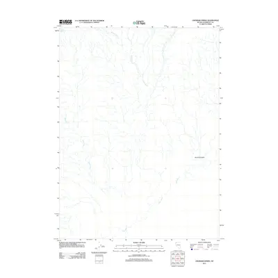
2011 Map of Crowbar Spring
USGS Topo · Published 2011About this map
Crowbar Spring serves as a vital water source in this arid corner of Humboldt County, positioned at the edge of the expansive Black Rock Desert. This 2011 survey illustrates a landscape defined by seasonal hydrography, where the Quinn River meanders through the southern reaches of the quadrangle. The northern and western sectors are etched by the intermittent flows of Paiute Creek and Indian Creek, tracing natural drainage patterns toward the desert floor. This map captures the remote character of Nevada's high desert, emphasizing the critical relationship between sparse water sources and the surrounding open terrain. The lack of built infrastructure reflects the preservation of this region's wilderness state, where ephemeral watercourses dictate the geography.
Find a feature on this map
5 named features on this map. Tap any name to fly to it.
Don’t see what you’re looking for? This feature index may not catch every label — zoom into the map to look around manually.
Map Details
Editions of this 2011 Crowbar Spring Map
This is the sole edition of this map. No revisions or reprints were ever made.
Other maps of this area

1886 · Disaster
USGS Topo · 1:250,000

1893 · Disaster
USGS Topo · 1:250,000

1954 · Vya
USGS Topo · 1:250,000

1958 · Vya
USGS Topo · 1:250,000

1962 · Vya
USGS Topo · 1:250,000

1966 · King Lear Peak
USGS Topo · 1:62,500

1972 · Pinto Mountain
USGS Topo · 1:24,000
1972 · Leonard Cr. Slough South
USGS Topo · 1:24,000
1972 · Paiute Meadows
USGS Topo · 1:24,000
1979 · Pidgeon Spring
USGS Topo · 1:24,000