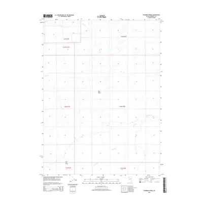
2015 Map of Crowbar Spring
USGS Topo · Published 2015About this map
Crowbar Spring serves as a critical water point in this arid expanse of the Great Basin, located where the Black Rock Range meets the edge of the Black Rock Desert. This 2015 survey reveals a landscape defined by seasonal watercourses and vast alkaline flats, where the intermittent Quinn River meanders across the lower reaches of the quadrangle. Drainages such as Paiute Cr and Indian Cr carve into the terrain from the north and west, illustrating the hydrology of a region where water is the primary architect of the environment. The map provides a precise layout of Public Land Survey System townships and ranges, marking the administrative grid over this undeveloped Nevada wilderness.
Find a feature on this map
13 named features on this map. Tap any name to fly to it.
Don’t see what you’re looking for? This feature index may not catch every label — zoom into the map to look around manually.
Map Details
Editions of this 2015 Crowbar Spring Map
This is the sole edition of this map. No revisions or reprints were ever made.
Other maps of this area

1886 · Disaster
USGS Topo · 1:250,000

1893 · Disaster
USGS Topo · 1:250,000

1954 · Vya
USGS Topo · 1:250,000

1958 · Vya
USGS Topo · 1:250,000

1962 · Vya
USGS Topo · 1:250,000

1966 · King Lear Peak
USGS Topo · 1:62,500

1972 · Pinto Mountain
USGS Topo · 1:24,000
1972 · Leonard Cr. Slough South
USGS Topo · 1:24,000
1972 · Paiute Meadows
USGS Topo · 1:24,000
1979 · Pidgeon Spring
USGS Topo · 1:24,000