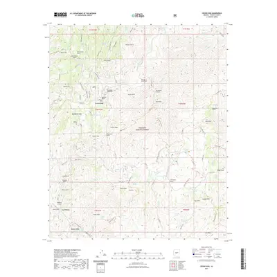
2021 Map of Crown King
USGS Topo · Published 2021About this map
The Bradshaw Mountains of Yavapai County dominate this landscape, centered on the mining settlement of Crown King. This area within the Prescott National Forest reveals a complex network of historic mountain roads and trails, such as the S Senator Hwy and Wagoner Tri, which reflect the region's long connection to mineral extraction and high-altitude ranching. The presence of Bradshaw City Cem near the site of Bradshaw City serves as a reminder of the short-lived gold rushes that once populated these slopes.
Find a feature on this map
117 named features on this map. Tap any name to fly to it.
Don’t see what you’re looking for? This feature index may not catch every label — zoom into the map to look around manually.
Map Details
Editions of this 2021 Crown King Map
This is the sole edition of this map. No revisions or reprints were ever made.
Other maps of this area

1887 · Prescott
USGS Topo · 1:250,000

1892 · Prescott
USGS Topo · 1:250,000

1903 · Bradshaw Mountains
USGS Topo · 1:125,000

1947 · Crown King
USGS Topo · 1:62,500

1947 · Bumblebee
USGS Topo · 1:62,500

1947 · Mayer
USGS Topo · 1:62,500

1947 · Mt. Union
USGS Topo · 1:62,500

1948 · Bumblebee
USGS Topo · 1:63,360

1948 · Crown King
USGS Topo · 1:63,360

1948 · Mt. Union
USGS Topo · 1:63,360