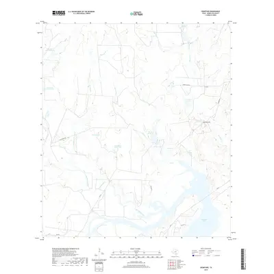
2019 Map of Crowther
USGS Topo · Published 2019About this map
Crowther stands as the primary named settlement in this arid ranching landscape of McMullen County, situated near the intersection of several rural routes like Jambers Rd and Jambers Ranch Rd. The terrain is defined by an extensive network of ephemeral drainage and man-made water catchments, reflecting the region's reliance on managed water resources for livestock. These features, often bearing local or family names, include Van Meter Tank, Pot of Gold Tank, and Persimmon Hollow Tank. To the south, the landscape opens into the significant basin of San Miguel Creek and Yarbrough Lake. This survey illustrates the modern ranching infrastructure of the Texas Brush Country, where prominent elevations like Opossum Hill overlook a complex system of creek branches, such as Mustang Br and Frenchman Br, that feed into the larger San Miguel watershed.
Find a feature on this map
27 named features on this map. Tap any name to fly to it.
Don’t see what you’re looking for? This feature index may not catch every label — zoom into the map to look around manually.
Map Details
Editions of this 2019 Crowther Map
This is the sole edition of this map. No revisions or reprints were ever made.
Other maps of this area

1920 · Mikeska
USGS Topo · 1:125,000

1925 · Simmons No. 1
USGS Topo · 1:48,000

1925 · Tilden No. 1
USGS Topo · 1:48,000

1925 · Crowther No. 3
USGS Topo · 1:48,000

1925 · Simmons No. 2
USGS Topo · 1:48,000

1929 · Simmons
USGS Topo · 1:62,500

1930 · Tilden
USGS Topo · 1:62,500

1930 · Whitsett
USGS Topo · 1:62,500

1942 · Tilden
USGS Topo · 1:62,500

1942 · Whitsett
USGS Topo · 1:62,500