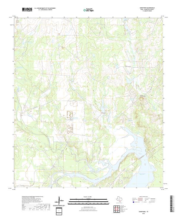
2022 Map of Crowther
USGS Topo · Published 2022About this map
The Choke Canyon Reservoir dominates the southeastern corner of this McMullen County landscape, where the Frio River and San Miguel Creek converge. The terrain is defined by a dense network of intermittent drainages like Mustang Br and Frenchman Br, feeding into an extensive system of private water management features. These ranching-era improvements include numerous named stock ponds such as Pot of Gold Tank, Van Meter Tank, and Persimmon Hollow Tank. The dominance of the Gubel Trust Lake Number 2 and Gubel Trust Lake Number 3 highlights the historical importance of water rights and land management in this arid Texas Brush Country. Surveyed ranch roads like Jambers Ranch Rd and Tyler Ranch Rd provide the primary access through this sparsely populated territory, leading toward the distinct elevation of Opossum Hill.
Find a feature on this map
28 named features on this map. Tap any name to fly to it.
Don’t see what you’re looking for? This feature index may not catch every label — zoom into the map to look around manually.
Map Details
Editions of this 2022 Crowther Map
This is the sole edition of this map. No revisions or reprints were ever made.
Other maps of this area

1920 · Mikeska
USGS Topo · 1:125,000

1925 · Simmons No. 1
USGS Topo · 1:48,000

1925 · Tilden No. 1
USGS Topo · 1:48,000

1925 · Crowther No. 3
USGS Topo · 1:48,000

1925 · Simmons No. 2
USGS Topo · 1:48,000

1929 · Simmons
USGS Topo · 1:62,500

1930 · Tilden
USGS Topo · 1:62,500

1930 · Whitsett
USGS Topo · 1:62,500

1942 · Tilden
USGS Topo · 1:62,500

1942 · Whitsett
USGS Topo · 1:62,500