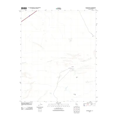
2012 Map of Crucero Hill
USGS Topo · Published 2012About this map
Crucero occupies a central position in this high-desert landscape, located at the intersection of Crucero Rd and Front St. This remote settlement is surrounded by a complex network of ephemeral drainage features, most notably the Mojave River Wash, which cuts across the central portion of the quadrangle. The topography is defined by the Mesquite Hills to the south and Crucero Hill to the east, illustrating a terrain shaped by wind and intermittent water flow. Further northeast, the Rasor Ranch sits near Rasor Rd, suggesting isolated habitation or agricultural attempts in an arid environment. The presence of Mesquite Spring indicates a critical water source in a region otherwise dominated by dry washes and hills. This survey provides a clear view of how road networks and small outposts were established relative to the natural geography of the California desert.
Find a feature on this map
9 named features on this map. Tap any name to fly to it.
Don’t see what you’re looking for? This feature index may not catch every label — zoom into the map to look around manually.
Map Details
Editions of this 2012 Crucero Hill Map
This is the sole edition of this map. No revisions or reprints were ever made.
Other maps of this area

1933 · Avawatz Mountains
USGS Topo · 1:250,000

1947 · Trona
USGS Topo · 1:250,000

1948 · Trona
USGS Topo · 1:250,000

1948 · Cave Mountain
USGS Topo · 1:62,500

1951 · Cave Mountain
USGS Topo · 1:62,500

1953 · San Bernardino
USGS Topo · 1:250,000

1953 · Trona
USGS Topo · 1:250,000

1955 · Cady Mountains
USGS Topo · 1:62,500

1955 · Broadwell Lake
USGS Topo · 1:62,500

1956 · San Bernardino
USGS Topo · 1:250,000