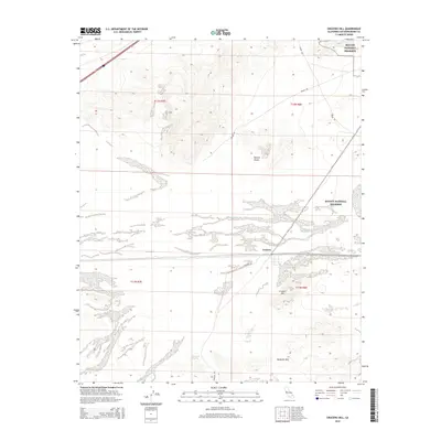
2015 Map of Crucero Hill
USGS Topo · Published 2015About this map
Crucero occupies a singular position in the eastern Mojave Desert, serving as a focal point within the sprawling Mojave National Preserve. The landscape is dominated by the ephemeral drainage of the Mojave River Wash, which cuts a wide path across the arid floor. Significant elevation changes are marked by the prominent Crucero Hill and the broader Mesquite Hills to the south. Historically significant routes such as Mojave Rd and Crucero Rd intersect this territory, tracing paths long used for desert transit. Near the base of the southern hills, Mesquite Spring provides a rare point of hydrologic interest in an otherwise parched environment. The layout of these roads and natural landmarks illustrates the enduring patterns of movement through the California interior.
Find a feature on this map
14 named features on this map. Tap any name to fly to it.
Don’t see what you’re looking for? This feature index may not catch every label — zoom into the map to look around manually.
Map Details
Editions of this 2015 Crucero Hill Map
This is the sole edition of this map. No revisions or reprints were ever made.
Other maps of this area

1933 · Avawatz Mountains
USGS Topo · 1:250,000

1947 · Trona
USGS Topo · 1:250,000

1948 · Trona
USGS Topo · 1:250,000

1948 · Cave Mountain
USGS Topo · 1:62,500

1951 · Cave Mountain
USGS Topo · 1:62,500

1953 · San Bernardino
USGS Topo · 1:250,000

1953 · Trona
USGS Topo · 1:250,000

1955 · Cady Mountains
USGS Topo · 1:62,500

1955 · Broadwell Lake
USGS Topo · 1:62,500

1956 · San Bernardino
USGS Topo · 1:250,000