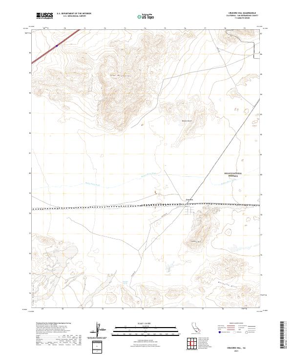
2021 Map of Crucero Hill
USGS Topo · Published 2021About this map
The tiny rail settlement of Crucero sits at a remote junction within the Mojave National Preserve, positioned where the arid basin floor meets the ephemeral course of the Mojave River Wash. This terrain is defined by dramatic elevation changes, moving from the low flats of the Mojave Desert up into the high relief of the Soda Mountains to the north and the Crucero Hill uplands to the south. The presence of Front St and Crucero Rd suggests the skeletal remains of a transit-dependent community that once served as a vital water and supply stop in the heart of the desert. The landscape is dotted with isolated water sources like Mesquite Spring, which offered rare relief to travelers and livestock moving between the Cady Mountains and the Mesquite Hills.
Find a feature on this map
12 named features on this map. Tap any name to fly to it.
Don’t see what you’re looking for? This feature index may not catch every label — zoom into the map to look around manually.
Map Details
Editions of this 2021 Crucero Hill Map
This is the sole edition of this map. No revisions or reprints were ever made.
Other maps of this area

1933 · Avawatz Mountains
USGS Topo · 1:250,000

1947 · Trona
USGS Topo · 1:250,000

1948 · Trona
USGS Topo · 1:250,000

1948 · Cave Mountain
USGS Topo · 1:62,500

1951 · Cave Mountain
USGS Topo · 1:62,500

1953 · San Bernardino
USGS Topo · 1:250,000

1953 · Trona
USGS Topo · 1:250,000

1955 · Cady Mountains
USGS Topo · 1:62,500

1955 · Broadwell Lake
USGS Topo · 1:62,500

1956 · San Bernardino
USGS Topo · 1:250,000