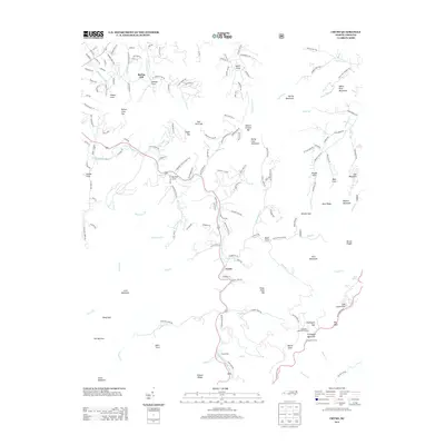
2013 Map of Cruso
USGS Topo · Published 2013About this map
The E Fork Pigeon River carves a deep path through this high-elevation landscape, anchoring the settlement of Cruso and the southern recreational facilities at Camp Hope. This 2013 survey reveals the intricate topography of the Blue Ridge, dominated by major peaks such as Mount Pisgah and Cold Mountain. The presence of the Fryingpan Mountain Lookout and the Fryingpan Pan Tunnel near Fryingpan Gap highlights the region's long-standing importance for forest management and transportation. Local genealogy and history are embedded in the naming of numerous coves and gaps, including Henson Cove, Brooks Cove, and Dutch Cove, while roads like Mica Mine Dr suggest the area's geological and industrial past. The map traces the winding route of U.S. 276 as it climbs toward the Blue Ridge Pkwy, passing Flat Laurel Gap and Beech Knob.
Find a feature on this map
166 named features on this map. Tap any name to fly to it.
Don’t see what you’re looking for? This feature index may not catch every label — zoom into the map to look around manually.
Map Details
Editions of this 2013 Cruso Map
This is the sole edition of this map. No revisions or reprints were ever made.
Other maps of this area

1894 · Asheville
USGS Topo · 1:125,000

1901 · Asheville
USGS Topo · 1:125,000

1905 · Pisgah
USGS Topo · 1:125,000

1906 · Pisgah
USGS Topo · 1:125,000

1935 · Cruso
USGS Topo · 1:24,000

1935 · Waynesville
USGS Topo · 1:24,000

1935 · Canton
USGS Topo · 1:24,000

1935 · Sam Knob
USGS Topo · 1:24,000

1935 · Clyde
USGS Topo · 1:24,000

1935 · Shining Rock
USGS Topo · 1:24,000