
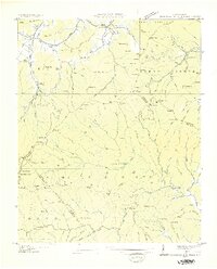
1935 Map of Shining Rock
USGS Topo · Published 1935About this map
Pisgah National Forest dominates this 1935 survey, showing the complex watershed where the Davidson River and Pigeon River headwaters emerge. The landscape is defined by its numerous gaps and knobs, serving as a record of the area before modern recreational infrastructure was fully developed. Of particular interest is the presence of CCC Camp F 1 near the confluence of Cove Creek and the Davidson River, marking the era of public works projects in North Carolina's high country.
Find a feature on this map
123 named features on this map. Tap any name to fly to it.
Don’t see what you’re looking for? This feature index may not catch every label — zoom into the map to look around manually.
Map Details
Editions of this 1935 Shining Rock Map
This is the sole edition of this map. No revisions or reprints were ever made.
Other maps of this area

1905 · Pisgah
USGS Topo · 1:125,000

1906 · Pisgah
USGS Topo · 1:125,000

1935 · Cruso
USGS Topo · 1:24,000

1935 · Brevard
USGS Topo · 1:24,000

1935 · Waynesville
USGS Topo · 1:24,000

1935 · Sam Knob
USGS Topo · 1:24,000

1935 · Rosman
USGS Topo · 1:24,000

1935 · Lake Toxaway
USGS Topo · 1:24,000

1935 · Pisgah Forest
USGS Topo · 1:24,000
1936 · Dunsmore Mountain
USGS Topo · 1:24,000