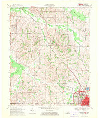
1969 Map of Crutchfield
USGS Topo · Published 1971About this map
The Illinois Central Railroad anchors the transportation geography of this region, cutting a diagonal path through the landscape of western Kentucky and northern Tennessee. This late-1960s survey documents the twin hubs of Fulton and South Fulton, where the state line bisects the urban grid. The rural landscape north of the city is defined by the winding course of Bayou de Chien and its tributaries, such as Cane Creek and Pond Branch.
Find a feature on this map
59 named features on this map. Tap any name to fly to it.
Don’t see what you’re looking for? This feature index may not catch every label — zoom into the map to look around manually.
Map Details
Editions of this 1969 Crutchfield Map
This is the sole edition of this map. No revisions or reprints were ever made.
Other maps of this area

1939 · Hickman
USGS Topo · 1:62,500

1951 · Cayce
USGS Topo · 1:24,000

1951 · Oakton
USGS Topo · 1:24,000

1952 · Clinton
USGS Topo · 1:24,000

1952 · Dublin
USGS Topo · 1:24,000

1952 · Crutchfield
USGS Topo · 1:24,000

1952 · Water Valley
USGS Topo · 1:24,000

1952 · Water Valley
USGS Topo · 1:62,500

1954 · Union City
USGS Topo · 1:24,000

1954 · Hickman
USGS Topo · 1:62,500