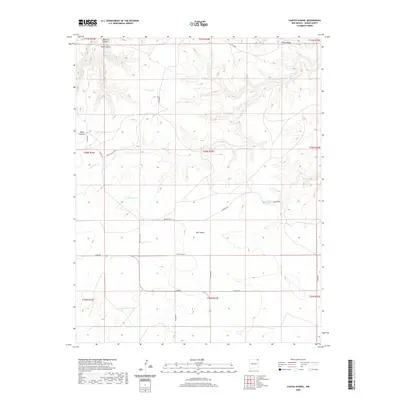
2020 Map of Cuates School
USGS Topo · Published 2020About this map
Cuates School stands as a central landmark in this high-plains landscape of northeastern New Mexico, where the terrain is defined by a series of deep drainages and ridges. The map reveals a remote ranching and grazing environment where water sources like Bruner Spring and Pacheco Spring were essential to settlement. The drainage of Carrizozo Cr cuts through the territory, flanked by prominent features such as Piñon Ridge and Stone Canyon.
Find a feature on this map
30 named features on this map. Tap any name to fly to it.
Don’t see what you’re looking for? This feature index may not catch every label — zoom into the map to look around manually.
Map Details
Editions of this 2020 Cuates School Map
This is the sole edition of this map. No revisions or reprints were ever made.
Other maps of this area

1954 · Dalhart
USGS Topo · 1:250,000

1958 · Dalhart
USGS Topo · 1:250,000

1962 · Dalhart
USGS Topo · 1:250,000

1972 · Seneca
USGS Topo · 1:24,000

1972 · Mc Laughlin Bridge
USGS Topo · 1:24,000
1972 · Wedding Cake Butte
USGS Topo · 1:24,000

1972 · Travesser Park
USGS Topo · 1:24,000
1972 · Guy
USGS Topo · 1:24,000

1972 · Cuates School
USGS Topo · 1:24,000

1972 · Atencio
USGS Topo · 1:24,000