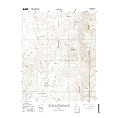
2013 Map of Cuba
USGS Topo · Published 2013About this map
Cuba serves as the primary hub at the edge of the Santa Fe National Forest, where the high desert terrain meets the western slopes of the San Pedro Mountains. This 2013 survey details a transition from the structured residential blocks and the Cuba Presbyterian Cemetery to the dispersed settlements and ranches of the Rito Puerco valley. To the north, the communities of La Jara and Upper La Jara are situated along the La Jara Creek drainage, connected by local routes like Co Road 496. The landscape is defined by significant elevation changes, from the prominent Mesa de Cuba in the southwest to the mountain recreational sites including Kit Carson Boy Scout Camp and Camp Zia in the eastern highlands. The map provides a detailed view of the water sources vital to the region, including Gurule Spring and McCoy Spring, and the network of forest roads such as Los Pinos Co Rd that weave through the national forest boundaries.
Find a feature on this map
69 named features on this map. Tap any name to fly to it.
Don’t see what you’re looking for? This feature index may not catch every label — zoom into the map to look around manually.
Map Details
Editions of this 2013 Cuba Map
This is the sole edition of this map. No revisions or reprints were ever made.
Other maps of this area

1883 · Mt. Taylor
USGS Topo · 1:250,000

1886 · Mt. Taylor
USGS Topo · 1:250,000

1889 · Largo
USGS Topo · 1:250,000

1890 · Jemes
USGS Topo · 1:125,000

1892 · Jemes
USGS Topo · 1:125,000

1892 · Mt. Taylor
USGS Topo · 1:250,000

1895 · Largo
USGS Topo · 1:250,000

1899 · Mt. Taylor
USGS Topo · 1:250,000

1909 · Gallina
USGS Topo · 1:125,000

1939 · La Ventana
USGS Topo · 1:62,500