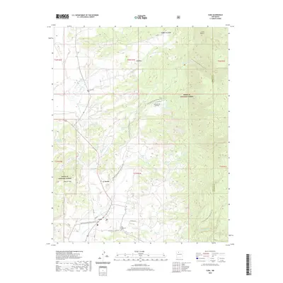
2020 Map of Cuba
USGS Topo · Published 2020About this map
Cuba serves as the primary hub in this northwestern New Mexico landscape, situated at the base of the high country where the Santa Fe National Forest begins its ascent. The map documents a rural corridor of small settlements including La Jara, Upper La Jara, and La Placita, connected by a network of local roads like Nacimiento Rd and Cubita Rd. The transition from the flatlands of Mesa de Cuba to the complex drainages of the Rio Puerco and Nacimiento Cr defines the local geography. Significant for genealogists and local historians, the sheet identifies specific community sites such as the Cuba Presbyterian Cem and La Jara Cem. The presence of the Continental Divide National Scenic Trail winding through the terrain highlights the area's importance for transit and recreation, passing through regions dotted with isolated water sources like Brodrick Spring and Laguna Bonita.
Find a feature on this map
44 named features on this map. Tap any name to fly to it.
Don’t see what you’re looking for? This feature index may not catch every label — zoom into the map to look around manually.
Map Details
Editions of this 2020 Cuba Map
This is the sole edition of this map. No revisions or reprints were ever made.
Other maps of this area

1883 · Mt. Taylor
USGS Topo · 1:250,000

1886 · Mt. Taylor
USGS Topo · 1:250,000

1889 · Largo
USGS Topo · 1:250,000

1890 · Jemes
USGS Topo · 1:125,000

1892 · Jemes
USGS Topo · 1:125,000

1892 · Mt. Taylor
USGS Topo · 1:250,000

1895 · Largo
USGS Topo · 1:250,000

1899 · Mt. Taylor
USGS Topo · 1:250,000

1909 · Gallina
USGS Topo · 1:125,000

1939 · La Ventana
USGS Topo · 1:62,500