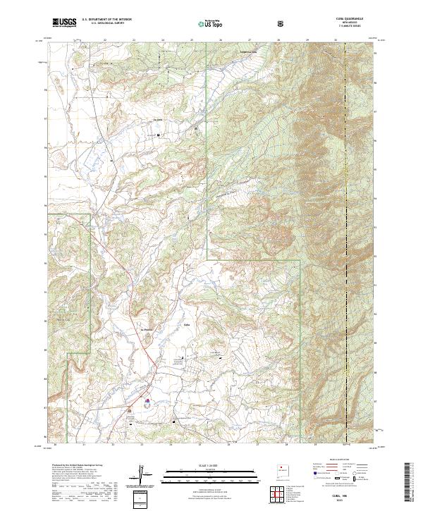
2023 Map of Cuba
USGS Topo · Published 2023About this map
Cuba serves as the primary hub of this high-desert region, where the Rio Puerco and Nacimiento Creek meet against the backdrop of the Santa Fe National Forest. This 2023 survey documents a landscape where agricultural traditions and mountain access define the settlement pattern, with smaller outposts like La Placita, La Jara, and Upper La Jara following the path of the canyons and watercourses. Genealogists will find several burial grounds noted, including the Immaculate Conception Catholic Cem, Cuba Presbyterian Cem, and La Jara Cem. The terrain is marked by significant elevation changes, from the flat tops of Mesa de Cuba to the high peaks of the San Pedro Parks Wilderness. Modern recreation is represented by the Continental Divide National Scenic Trl, which traverses the southern portion of the sheet near Miera Rd.
Find a feature on this map
47 named features on this map. Tap any name to fly to it.
Don’t see what you’re looking for? This feature index may not catch every label — zoom into the map to look around manually.
Map Details
Editions of this 2023 Cuba Map
This is the sole edition of this map. No revisions or reprints were ever made.
Other maps of this area

1883 · Mt. Taylor
USGS Topo · 1:250,000

1886 · Mt. Taylor
USGS Topo · 1:250,000

1889 · Largo
USGS Topo · 1:250,000

1890 · Jemes
USGS Topo · 1:125,000

1892 · Jemes
USGS Topo · 1:125,000

1892 · Mt. Taylor
USGS Topo · 1:250,000

1895 · Largo
USGS Topo · 1:250,000

1899 · Mt. Taylor
USGS Topo · 1:250,000

1909 · Gallina
USGS Topo · 1:125,000

1939 · La Ventana
USGS Topo · 1:62,500