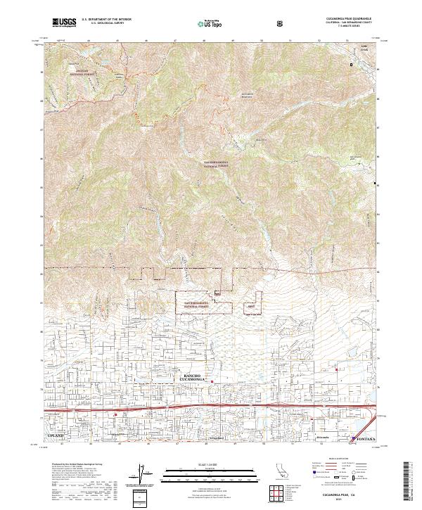
2021 Map of Cucamonga Peak
USGS Topo · Published 2021About this map
Rancho Cucamonga and its neighboring communities of Alta Loma and Etiwanda are situated at the dramatic meeting point of the San Gabriel Mountains and the urbanized valley floor. This 2021 study shows the suburban expansion of the northern Inland Empire, where street grids like Alta Loma Dr and Wilson Ave terminate abruptly against the rising slopes of the San Bernardino National Forest. The transition from education and residential life at Chaffey College to the wilderness of Icehouse Canyon is documented in high detail, illustrating how the modern city interfaces with steep drainage systems like Day Canyon and Deer Canyon. Along the southern edge of the sheet, the Pacific Electric Trl marks a legacy transportation corridor through Grapeland, now repurposed for recreation. The northern half of the map is dominated by high-altitude features including Cucamonga Peak and Ontario Peak, connected by an extensive network of trails such as the Telegraph Wash and Three T's Trl.
Find a feature on this map
105 named features on this map. Tap any name to fly to it.
Don’t see what you’re looking for? This feature index may not catch every label — zoom into the map to look around manually.
Map Details
Editions of this 2021 Cucamonga Peak Map
This is the sole edition of this map. No revisions or reprints were ever made.
Other maps of this area

1896 · San Bernardino
USGS Topo · 1:62,500

1897 · Cucamonga
USGS Topo · 1:62,500

1898 · San Bernardino
USGS Topo · 1:62,500

1900 · Cucamonga
USGS Topo · 1:62,500

1901 · Southern California Sheet No. 1
USGS Topo · 1:250,000

1901 · San Bernardino
USGS Topo · 1:62,500

1902 · Hesperia
USGS Topo · 1:62,500

1903 · Cucamonga
USGS Topo · 1:62,500

1903 · San Antonio
USGS Topo · 1:62,500

1904 · Southern California Sheet No. 1
USGS Topo · 1:250,000