
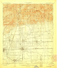
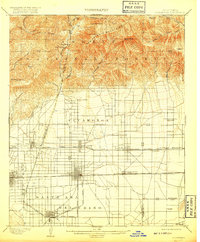
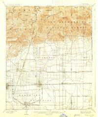
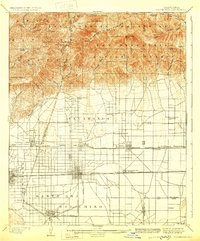
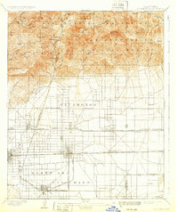
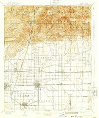
1903 Map of Cucamonga
USGS Topo · Published 1903About this map
The San Antonio Mountains dominate the northern landscape of this survey, which captures the burgeoning agricultural and transit corridor of the Inland Empire at the turn of the century. The map reveals a highly structured grid of citrus groves and vineyards emerging below the San Gabriel Timber Land Reserve, serviced by an intensive network of competing rail lines. The Atchison Topeka and Santa Fe R. R. and the Southern Pacific R. R. cut through the heart of the valley, supporting established centers like Ontario and Pomona alongside smaller rail stops such as Etiwanda Sta. and Rochester.
Find a feature on this map
72 named features on this map. Tap any name to fly to it.
Don’t see what you’re looking for? This feature index may not catch every label — zoom into the map to look around manually.
Map Details
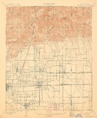
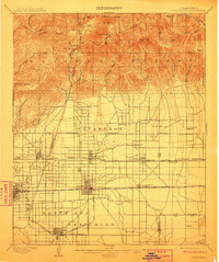
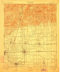
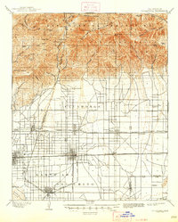
Editions of this 1903 Cucamonga Map
11 editions found
1903 edition
16.46 x 19.86 inches
1906 edition
16.6 x 20 inches
1908 edition
16.44 x 19.77 inches
1911 edition
16.6 x 19.8 inches
1912 edition
16.6 x 19.8 inches
1917 edition
16.6 x 20.1 inches
1927 edition
16.6 x 19.8 inches
1929 edition
16.4 x 19.8 inches
1932 edition
16.6 x 19.8 inches
1939 edition
16.6 x 19.8 inches
1947 edition
16.7 x 20.8 inches
Other maps of this area

1894 · Pomona
USGS Topo · 1:62,500

1896 · Anaheim
USGS Topo · 1:62,500

1896 · San Bernardino
USGS Topo · 1:62,500

1897 · Pomona
USGS Topo · 1:62,500

1897 · Cucamonga
USGS Topo · 1:62,500

1898 · Pomona
USGS Topo · 1:62,500

1898 · San Bernardino
USGS Topo · 1:62,500

1898 · Anaheim
USGS Topo · 1:62,500

1900 · Cucamonga
USGS Topo · 1:62,500

1901 · Southern California Sheet No. 1
USGS Topo · 1:250,000