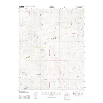
2013 Map of Cucharas Pass
USGS Topo · Published 2013About this map
Cuchara serves as the primary hub in this mountain corridor where State Hwy 12 winds through the San Isabel National Forest. This 2013 survey illustrates the recreational and ranching character of the high country, marking sites like the Cuchara Valley Ski Area and the Parsons Cow Camp. The map provides a look at the transition between Huerfano and Las Animas counties, defined by significant alpine crossings at Cucharas Pass and Cordova Pass. Peaks such as Middle White Peak and Boyd Mountain dominate the skyline, while a dense network of forest trails, including the Dodgeton Trail 1302 and Wildcat Trail 1312, suggests the area's long history of backcountry access and land management.
Find a feature on this map
70 named features on this map. Tap any name to fly to it.
Don’t see what you’re looking for? This feature index may not catch every label — zoom into the map to look around manually.
Map Details
Editions of this 2013 Cucharas Pass Map
This is the sole edition of this map. No revisions or reprints were ever made.
Other maps of this area

1891 · Spanish Peaks
USGS Topo · 1:125,000

1893 · Spanish Peaks
USGS Topo · 1:125,000

1895 · Spanish Peaks
USGS Topo · 1:125,000

1897 · Spanish Peaks
USGS Topo · 1:125,000

1900 · Spanish Peaks
USGS Topo · 1:125,000

1954 · Trinidad
USGS Topo · 1:250,000

1955 · Trinidad
USGS Topo · 1:250,000

1958 · Trinidad
USGS Topo · 1:250,000

1959 · Trinidad
USGS Topo · 1:250,000

1963 · Mc Carty Park
USGS Topo · 1:24,000