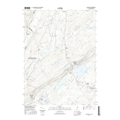
2016 Map of Culvers Gap
USGS Topo · Published 2016About this map
The ridge-and-valley landscape of the Kittatinny Mtn range defines this 2016 survey, where the Delaware River forms the state boundary near the historic crossing at Dingmans Ferry. This area is heavily defined by its protected natural spaces, including the Delaware Water Gap National Recreation Area and the Appalachian National Scenic Trail, which winds along the ridgelines through Culvers Gap. Local history is preserved in several burial grounds such as Delaware Cem and Wallpack Cem, which sit near old settlement sites like Bevans and Layton. The geography is notably water-rich, featuring a dense network of glacial lakes including Culvers Lake, Lake Owassa, and the smaller Lake Ashroe. These water bodies and the surrounding woodlands create a distinct recreational and residential pattern characteristic of Sussex County, anchored in the southeast by the community of Branchville.
Find a feature on this map
43 named features on this map. Tap any name to fly to it.
Don’t see what you’re looking for? This feature index may not catch every label — zoom into the map to look around manually.
Map Details
Editions of this 2016 Culvers Gap Map
This is the sole edition of this map. No revisions or reprints were ever made.
Other maps of this area

1888 · Franklin
USGS Topo · 1:62,500

1891 · Wallpack
USGS Topo · 1:62,500

1893 · Wallpack
USGS Topo · 1:62,500

1894 · Franklin
USGS Topo · 1:62,500

1897 · Franklin
USGS Topo · 1:62,500

1903 · Franklin Furnace
USGS Topo · 1:62,500

1906 · Port Jervis
USGS Topo · 1:62,500

1908 · Port Jervis
USGS Topo · 1:62,500

1913 · Milford
USGS Topo · 1:62,500

1915 · Milford
USGS Topo · 1:62,500
Featured Places
- Hampton Township, NJ
- Stillwater Township, NJ
- Montague Township, NJ
- Branchville, NJ
- Culvers Inlet, Frankford Township