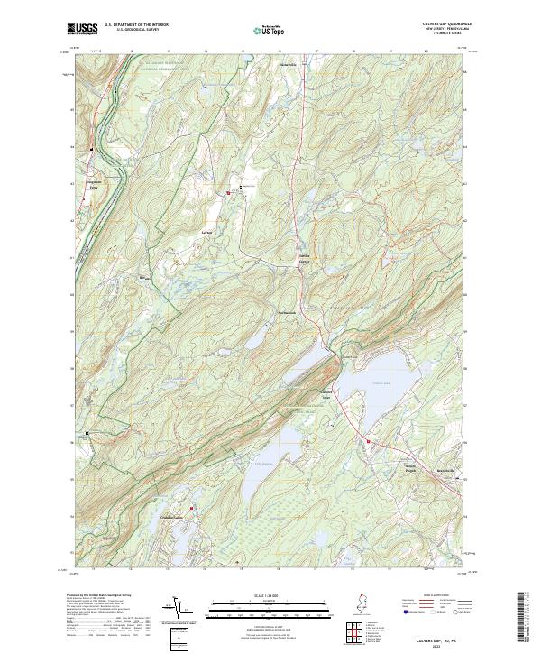
2023 Map of Culvers Gap
USGS Topo · Published 2023About this map
The Delaware National Scenic River serves as the western boundary for this Sussex County landscape, where the waters of Dingmans Creek meet the river at Dingmans Ferry. To the southeast, the terrain rises sharply toward Kittatinny Mtn, a ridge crossed by the Appalachian National Scenic Trail. This area is defined by a series of glacial lakes and springs, including the large waters of Culvers Lake and the smaller Lake Ocquittunk. Small settlements like Layton, Bevans, and Tuttles Corner are linked by a network of historic routes such as Old Mine Rd. Genealogy researchers can find several burial grounds, including Wallpack Cem and Layton Cem, while the presence of the Delaware Water Gap National Recreation Area indicates the transition from private land to public conservation. The southeastern corner features the larger hub of Branchville, positioned near Mount Pisgah.
Find a feature on this map
150 named features on this map. Tap any name to fly to it.
Don’t see what you’re looking for? This feature index may not catch every label — zoom into the map to look around manually.
Map Details
Editions of this 2023 Culvers Gap Map
This is the sole edition of this map. No revisions or reprints were ever made.
Other maps of this area

1888 · Franklin
USGS Topo · 1:62,500

1891 · Wallpack
USGS Topo · 1:62,500

1893 · Wallpack
USGS Topo · 1:62,500

1894 · Franklin
USGS Topo · 1:62,500

1897 · Franklin
USGS Topo · 1:62,500

1903 · Franklin Furnace
USGS Topo · 1:62,500

1906 · Port Jervis
USGS Topo · 1:62,500

1908 · Port Jervis
USGS Topo · 1:62,500

1913 · Milford
USGS Topo · 1:62,500

1915 · Milford
USGS Topo · 1:62,500