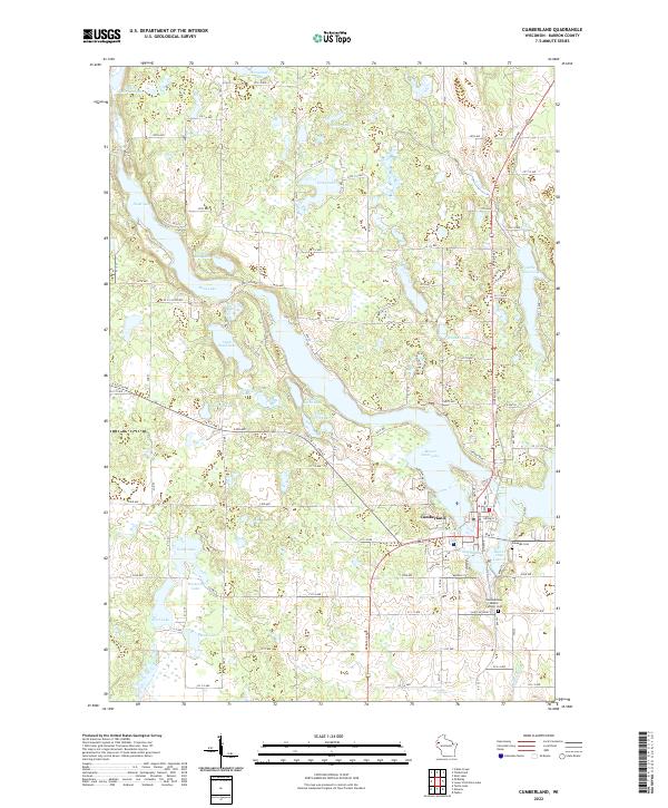
1982 Map of Cumberland
USGS Topo · Published 1983About this map
The city of Cumberland sits as an island-like community nearly surrounded by the waters of Beaver Dam Lake, serving as a central hub for the surrounding glacial landscape of Barron County during the early 1980s. This survey illustrates the intricate relationship between the town's grid and its aquatic borders, with Eagle Point Park and multiple public access points lining the shore. The Chicago and North Western railroad corridor cuts through the eastern edge of the settlement, linking the local economy to the broader region. To the north and west, the terrain transitions into the Maple Plain, a mosaic of wetlands and named water bodies such as Crystal Lake and Sand Lake. The map also identifies significant cultural sites including the Saint Croix Indian Reservation and several historic burial grounds like Lakeside Cem and Gravel Cem, providing a detailed view of the area's social and geographic structure.
Find a feature on this map
50 named features on this map. Tap any name to fly to it.
Don’t see what you’re looking for? This feature index may not catch every label — zoom into the map to look around manually.
Map Details
Editions of this 1982 Cumberland Map
This is the sole edition of this map. No revisions or reprints were ever made.
Historical Maps of Cumberland Through Time
4 maps found