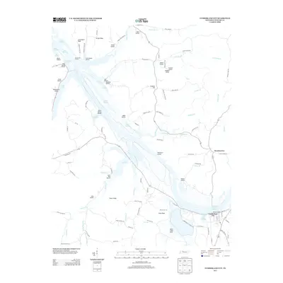
2013 Map of Cumberland City
USGS Topo · Published 2013About this map
Cumberland City sits at a strategic bend in the Cumberland River, where the modern landscape is dominated by the expansive Lake Barkley. This survey illustrates the complex relationship between the waterway and the surrounding Stewart County terrain, featuring several historical landing points such as Bear Springs Landing and McCartys Landing. The topography is defined by a dense network of ridges and hollows, including Commissary Ridge and the descriptively named Potatopatch Hollow. To the south, the Wells Creek Basin provides a distinct geographical contrast to the upland ridges like Traylor Ridge. Evidence of early industry and settlement patterns is preserved in labels such as Furnace Hollow and small nodes like Throckmorton, while the many drainages like Big Elk Cr and Wells Cr continue to shape the rural character of the region.
Find a feature on this map
99 named features on this map. Tap any name to fly to it.
Don’t see what you’re looking for? This feature index may not catch every label — zoom into the map to look around manually.
Map Details
Editions of this 2013 Cumberland City Map
This is the sole edition of this map. No revisions or reprints were ever made.
Other maps of this area

1931 · Erin
USGS Topo · 1:62,500

1936 · Tantrough Hollow
USGS Topo · 1:24,000

1936 · Stewart
USGS Topo · 1:24,000

1936 · Dover
USGS Topo · 1:24,000

1950 · Stewart
USGS Topo · 1:24,000

1950 · Dover
USGS Topo · 1:24,000

1951 · Indian Mound
USGS Topo · 1:24,000

1951 · Bumpus Mills
USGS Topo · 1:24,000

1951 · Woodlawn
USGS Topo · 1:24,000

1956 · Nashville
USGS Topo · 1:250,000