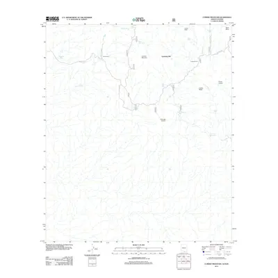
2012 Map of Cumero Mountain
USGS Topo · Published 2012About this map
Sandwash Mill stands as a primary industrial landmark in this arid Pima County landscape, situated just east of the prominent Cumero Mountain. The terrain is defined by a complex network of seasonal drainages, including Arrieta Wash and Canoa Wash, which flow toward the southern border. Water management is a central theme of the map's labels, evidenced by numerous tanks and improvements like Slick Rock Tank, Coches Windmill, and Cantina Reservoir, supporting both local ranching and technical operations. Local habitation is represented by Garcia Ranch, while specialized land use is noted at the Vol Researchbas. To the northeast, the elevation rises toward Lesna Peak and Black Mesa, overlooking a series of canyons and ridges that reveal the area's high-desert character.
Find a feature on this map
23 named features on this map. Tap any name to fly to it.
Don’t see what you’re looking for? This feature index may not catch every label — zoom into the map to look around manually.
Map Details
Editions of this 2012 Cumero Mountain Map
This is the sole edition of this map. No revisions or reprints were ever made.
Other maps of this area

1920 · Arivaca
USGS Topo · 1:125,000

1921 · Old Glory
USGS Topo · 1:125,000

1941 · Presumido Peak
USGS Topo · 1:62,500

1941 · Arivaca
USGS Topo · 1:62,500

1942 · Oro Blanco
USGS Topo · 1:62,500

1943 · Fresnal
USGS Topo · 1:125,000

1943 · Arivaca
USGS Topo · 1:62,500

1943 · Old Glory
USGS Topo · 1:125,000

1943 · Presumido Peak
USGS Topo · 1:62,500

1944 · Oro Blanco
USGS Topo · 1:62,500