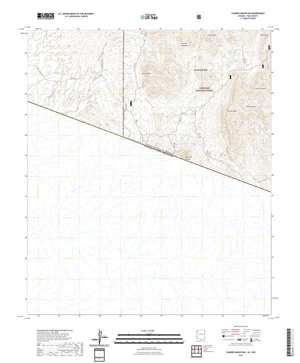
2021 Map of Cumero Mountain
USGS Topo · Published 2021About this map
The international border between the United States of America and Mexico bisects this Pima County landscape, where the southern reaches of the Buenos Aires National Wildlife Refuge meet the Coronado National Forest. This arid terrain is defined by its water management systems, featuring a network of isolated catchments like Marijuana Tank, Alamito Tank, and Coche Tank that supported cattle ranching and wildlife in the high desert.
Find a feature on this map
30 named features on this map. Tap any name to fly to it.
Don’t see what you’re looking for? This feature index may not catch every label — zoom into the map to look around manually.
Map Details
Editions of this 2021 Cumero Mountain Map
This is the sole edition of this map. No revisions or reprints were ever made.
Other maps of this area

1920 · Arivaca
USGS Topo · 1:125,000

1921 · Old Glory
USGS Topo · 1:125,000

1941 · Presumido Peak
USGS Topo · 1:62,500

1941 · Arivaca
USGS Topo · 1:62,500

1942 · Oro Blanco
USGS Topo · 1:62,500

1943 · Fresnal
USGS Topo · 1:125,000

1943 · Arivaca
USGS Topo · 1:62,500

1943 · Old Glory
USGS Topo · 1:125,000

1943 · Presumido Peak
USGS Topo · 1:62,500

1944 · Oro Blanco
USGS Topo · 1:62,500