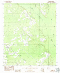
1988 Map of Cummings
USGS Topo · Published 1988About this map
Cummings and the nearby settlement of Fechtig anchor the landscape of Hampton County during the late 1980s, serving as small hubs in a region defined by its dense river systems. The Salkehatchie River and the Combahee R wind through the terrain, joined by several local tributaries including Tennants Branch and Ricepatch Creek. The map reveals a rural environment where infrastructure like a prominent Transmission Line and various Tram Lines intersect with the natural drainage basins. Local history is recorded in the placement of several Cem sites, which are scattered among the waterways like Deep Creek and McPherson Creek. This era of the Lowcountry shows a clear pattern of land use where small clusters of habitations are connected by local roads and specialized 4WD tracks, maintaining a layout shaped by the surrounding wetlands and river forks.
Find a feature on this map
14 named features on this map. Tap any name to fly to it.
Don’t see what you’re looking for? This feature index may not catch every label — zoom into the map to look around manually.
Map Details
Editions of this 1988 Cummings Map
This is the sole edition of this map. No revisions or reprints were ever made.
Other maps of this area

1918 · Varnville
USGS Topo · 1:62,500

1918 · Yemassee
USGS Topo · 1:62,500

1919 · Pineland
USGS Topo · 1:62,500

1919 · Cummings
USGS Topo · 1:62,500

1943 · Pineland
USGS Topo · 1:62,500

1943 · Yemassee
USGS Topo · 1:62,500

1943 · Cummings
USGS Topo · 1:62,500

1944 · Varnville
USGS Topo · 1:62,500

1947 · Savannah
USGS Topo · 1:250,000

1948 · Savannah
USGS Topo · 1:250,000