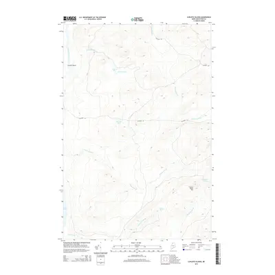
2014 Map of Cunliffe Islands
USGS Topo · Published 2014About this map
Cunliffe Islands sit within the flowing waters of the Allagash River in this remote section of northern Maine. The landscape is defined by its extensive drainage network, where Sweeney Brook, Henderson Brook, and Shepherd Brook carve through high-relief terrain. Notable elevations include Glazier Brook Mtn, which overlooks a series of isolated water bodies such as Threemile Pond and Glazier Pond. To the southwest, the northern reaches of Long Lake emerge, fed by Glazier Brook. Human passage through these woods is limited to a handful of forest routes, primarily Blanchet Rd and California Rd, reflecting the area's history of timber management and traditional wilderness access. The map captures the complex hydrology of the region, from the N Br Glazier Brook to the smaller McCluskey Brook.
Find a feature on this map
17 named features on this map. Tap any name to fly to it.
Don’t see what you’re looking for? This feature index may not catch every label — zoom into the map to look around manually.
Map Details
Editions of this 2014 Cunliffe Islands Map
This is the sole edition of this map. No revisions or reprints were ever made.
Other maps of this area

1932 · Umsaskis Lake
USGS Topo · 1:48,000

1932 · Musquacook Lakes
USGS Topo · 1:48,000

1932 · Allagash Falls
USGS Topo · 1:48,000

1935 · Umsaskis Lake
USGS Topo · 1:62,500

1935 · Musquacook Lakes
USGS Topo · 1:62,500

1935 · Allagash Falls
USGS Topo · 1:62,500

1954 · Presque Isle
USGS Topo · 1:250,000

1955 · Round Pond
USGS Topo · 1:62,500

1956 · Allagash Falls
USGS Topo · 1:50,000

1958 · Presque Isle
USGS Topo · 1:250,000