
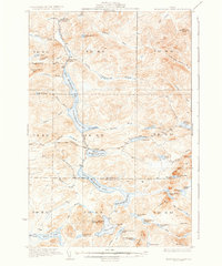
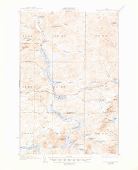
1935 Map of Musquacook Lakes
USGS Topo · Published 1935About this map
First Musquacook Lake and its sister waters form a dramatic north-south chain through the wilderness of northern Maine, captured here in the early 1930s. This interior landscape at the border of Aroostook and Piscataquis Counties is defined by a complex network of waterways, from the Lower Horse Race Rapids to the quiet reaches of Squirrel Pond. The absence of developed towns is replaced by industrial and recreational infrastructure, notably the American Realty Tote Road which provided essential access for logging operations during this era.
Find a feature on this map
74 named features on this map. Tap any name to fly to it.
Don’t see what you’re looking for? This feature index may not catch every label — zoom into the map to look around manually.
Map Details
Editions of this 1935 Musquacook Lakes Map
3 editions found
Other maps of this area

1931 · Fish River Lake
USGS Topo · 1:48,000

1931 · Mooseleuk Lake
USGS Topo · 1:48,000

1932 · Umsaskis Lake
USGS Topo · 1:48,000

1932 · Musquacook Lakes
USGS Topo · 1:48,000

1932 · Allagash Falls
USGS Topo · 1:48,000

1935 · Umsaskis Lake
USGS Topo · 1:62,500

1935 · Fish River Lake
USGS Topo · 1:62,500

1935 · Mooseleuk Lake
USGS Topo · 1:62,500

1935 · Allagash Falls
USGS Topo · 1:62,500

1954 · Spider Lake
USGS Topo · 1:62,500