
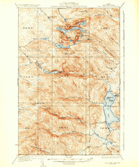
1935 Map of Fish River Lake
USGS Topo · Published 1935About this map
Fish River Lake and the surrounding unorganized townships of Aroostook County are depicted here following a 1931 survey that utilized early aerial photography by the U.S. Army Air Corps. The landscape is defined by a dense network of remote outposts and logging-era infrastructure, including Wheelock Mill and Michauds Mill in the northern reaches. The presence of numerous named camps, such as Red River Camps, Bishops Camps, and Blanchards Depot Camp, highlights the area's history as a destination for sportsmen and timber workers.
Find a feature on this map
64 named features on this map. Tap any name to fly to it.
Don’t see what you’re looking for? This feature index may not catch every label — zoom into the map to look around manually.
Map Details
Editions of this 1935 Fish River Lake Map
3 editions found
Other maps of this area

1928 · Eagle Lake
USGS Topo · 1:48,000

1928 · Winterville
USGS Topo · 1:48,000

1930 · Greenlaw
USGS Topo · 1:48,000

1930 · Allagash
USGS Topo · 1:48,000

1930 · St Francis
USGS Topo · 1:48,000

1931 · Fish River Lake
USGS Topo · 1:48,000

1931 · Mooseleuk Lake
USGS Topo · 1:48,000

1931 · Eagle Lake
USGS Topo · 1:62,500

1931 · Winterville
USGS Topo · 1:62,500

1932 · Musquacook Lakes
USGS Topo · 1:48,000