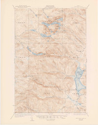
1935 Map of Fish River Lake
USGS Topo · Published 1947About this map
Timber harvesting and backcountry recreation define this survey of northern Maine, where Wheelock Mill and Michauds Mill stand as key industrial markers along the northern waters. The landscape is a network of working camps and seasonal retreats, from the Blanchards Depot Camp and Bouchers Camp to the more recreational clusters at Bishops Camps. This was a time when the North Woods were accessed primarily by tote roads and trails, supporting a rugged economy of forestry and sporting.
Find a feature on this map
70 named features on this map. Tap any name to fly to it.
Don’t see what you’re looking for? This feature index may not catch every label — zoom into the map to look around manually.
Map Details
Editions of this 1935 Fish River Lake Map
3 editions found

Other maps of this area

1928 · Eagle Lake
USGS Topo · 1:48,000

1928 · Winterville
USGS Topo · 1:48,000

1930 · Greenlaw
USGS Topo · 1:48,000

1930 · Allagash
USGS Topo · 1:48,000

1930 · St Francis
USGS Topo · 1:48,000

1931 · Fish River Lake
USGS Topo · 1:48,000

1931 · Mooseleuk Lake
USGS Topo · 1:48,000

1931 · Eagle Lake
USGS Topo · 1:62,500

1931 · Winterville
USGS Topo · 1:62,500

1932 · Musquacook Lakes
USGS Topo · 1:48,000