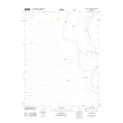
2012 Map of Currant Mountain
USGS Topo · Published 2012About this map
Currant Mountain dominates the high-elevation landscape of this 2012 survey, marking a significant peak within the White Pine Range. The map details a complex high-desert environment defined by dramatic elevation changes, from the heights of Duckwater Peak to the depression of Corduroy Basin. This region is characterized by a reliance on critical water sources like Deer Spring, Limerick Spring, and Saddle Spring, which would have been vital for any historical livestock operations or travelers moving through the area. Human passage is marked by a network of high-clearance routes, including Natl Forest Develop Road 405 Rd crossing through Beef Pass. Small drainages such as Currant Cr and the upper reaches of the White River illustrate the drainage patterns of this arid terrain, providing a look at the essential topography that shaped land use in this part of Nevada.
Find a feature on this map
20 named features on this map. Tap any name to fly to it.
Don’t see what you’re looking for? This feature index may not catch every label — zoom into the map to look around manually.
Map Details
Editions of this 2012 Currant Mountain Map
This is the sole edition of this map. No revisions or reprints were ever made.
Other maps of this area

1949 · Treasure Hill
USGS Topo · 1:62,500

1950 · Treasure Hill
USGS Topo · 1:62,500

1951 · Green Springs
USGS Topo · 1:62,500

1956 · Lund
USGS Topo · 1:250,000

1956 · Ely
USGS Topo · 1:250,000

1957 · Currant Mtn
USGS Topo · 1:62,500

1959 · Ely
USGS Topo · 1:250,000

1960 · Lund
USGS Topo · 1:250,000

1963 · Ely
USGS Topo · 1:250,000

1964 · Duckwater
USGS Topo · 1:62,500