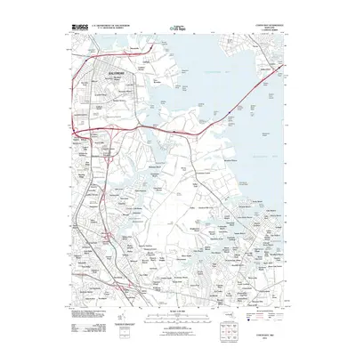
2011 Map of Curtis Bay
USGS Topo · Published 2011About this map
Baltimore's industrial southern edge and the residential expansion into northern Anne Arundel County define this coastal landscape along the Chesapeake Bay. The map captures the complex logistics of the Patapsco waterfront, featuring the Dundalk Marine Terminal and the Fairfield Auto Terminal alongside deep-water points like Hawkins Point and Sollers Point. Inland, the transition from urban neighborhoods like Brooklyn and Curtis Bay to suburban developments such as Arundel Gardens and Glen Gardens is marked by a dense concentration of local history, including Cedar Hill Cemetery and the John Wesley Cemetery. The shoreline is deeply indented by Furnace Creek, Marley Creek, and Stony Creek, where various wharves and points suggest a persistent reliance on the water for both commerce and community layout.
Find a feature on this map
282 named features on this map. Tap any name to fly to it.
Don’t see what you’re looking for? This feature index may not catch every label — zoom into the map to look around manually.
Map Details
Editions of this 2011 Curtis Bay Map
This is the sole edition of this map. No revisions or reprints were ever made.
Other maps of this area

1893 · North Point
USGS Topo · 1:62,500

1893 · Gunpowder
USGS Topo · 1:62,500

1894 · Baltimore
USGS Topo · 1:62,500

1894 · Relay
USGS Topo · 1:62,500

1898 · Tolchester
USGS Topo · 1:125,000

1899 · Baltimore
USGS Topo · 1:62,500

1901 · Gunpowder
USGS Topo · 1:62,500

1903 · Tolchester
USGS Topo · 1:125,000

1904 · Baltimore
USGS Topo · 1:62,500

1904 · North Point
USGS Topo · 1:62,500